Chapter: 10th Social Science : Geography : Chapter 7 : Physical Geography of Tamil Nadu
Western Ghats in Tamil Nadu
Western Ghats
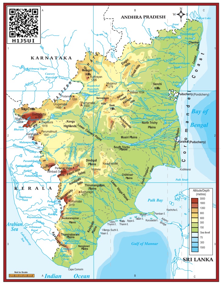
Western Ghats extend from the Niligris in the north to Marunthuvazh Malai at Swamithope in Kanyakumari district in the south. Height of the Western Ghats ranges from 2,000 to 3,000 metres. It covers an area of about 2,500 sq.km. Though the Western Ghats is a continuous range, it has some passes. The passes are Palghat, Shencottah, Aralvaimozhi, and Achankoil. The Niligris, Anaimalai, Palani hills, Cardamom hills, Varusanadu, Andipatti and Agasthiyar hills are the major hills of Western Ghats
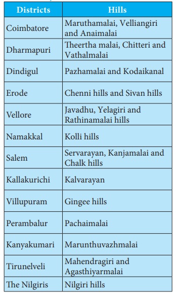
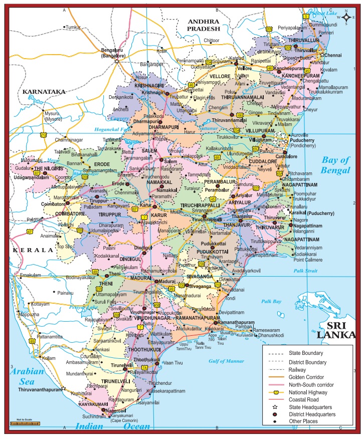
All districts of Tamil Nadu except the Chennai, The Nilgiris and Kanyakumari were bifurcated at different points of time.
Between which latitude and longitude, is your school located?
Nilgiri Hills
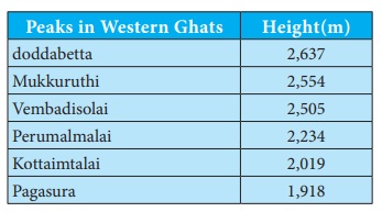
The Nilgiri hills is located in the Northwestern part of Tamil Nadu. It consists of 24 peaks with more than 2,000 metres height. Doddabetta is the highest peak (2,637 metres) of this hills followed by Mukkuruthi (2,554 metres). Ooty and Coonoor are the major hill stations located on this hills. It has more than 2,700 species of flowering plants and the state animal Nilgiri Tahr is found in this hill.
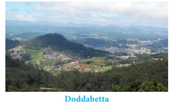
Anaimalai
Anaimalai is located in the border of Tamil Nadu and Kerala. It is located to the south of Palghat Gap. Anaimalai Tiger Reserve, Aliyar Reserved Forest, Valparai hill station, Kadamparai hydroelectric Power Plant are located on this hills. Aliyar and Tirumurthy dams are located at the foothills of this range.
Palani Hills
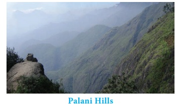
Palani hills are the eastward extension of the Western Ghats. These hills are located in Dindigul district. Vandaravu (2,533 metres) is the highest peak in the Palani hills. Vembadi Shola (2,505 metres) is its second highest peak. The hill station of Kodaikanal (2,150 metres) lies in the south central portion of the range.
Peaks in Western Ghats : Height(m)
doddabetta : 2,637
Mukkuruthi : 2,554
Vembadisolai : 2,505
Perumalmalai : 2,234
Kottaimtalai : 2,019
Pagasura : 1,918
Cardamom Hills
These hills are also known as Yela Mala hills located in the southwestern part of Tamil Nadu. It acquires its name from the cardamom spice, which is commonly grown here. Pepper and coffee are the other crops cultivated over the hills. They meet the Anaimalai hills in the northwest, the Palani hills in the northeast and Varusanadu and Andipatti hills in the southeast.
Varusanadu and Andipatti Hills
Another eastward extension of Western Ghats is Varusanadu and Andipatti hills. Megamalai (the highway mountain), Kalugumalai, Kurangani hill station, and Suruli and Kumbakarai waterfalls are found on these hills. Srivilliputhur Grizzled Squirrel Wild life Sanctuary is located in the southern slope of these hills in Virudhunagar district. Vaigai river and its tributaries originate in this region.
Pothigai Hills
Its major part lies in Tirunelveli district with its southern slope in the Kanyakumari district. Pothigai hills are called with different names such as the Shiva Jothi Parvath, Agasthiyar hills and Southern Kailash. These hills feature richest biodiversity in the Western Ghats. This area is known for its rich evergreen forest, waterfalls and ancient temples. Kalakkad Mundanthurai Tiger Reserve is located in this region.
Mahendragiri Hills
This continous range is situated along the border of Kanyakumari and Tirunelveli districts and is a part of the southern range of the Western Ghats. Its average height is 1,645 metres.
Why are mountain heights measured from mean sea level and not from ground level?
Related Topics