Chapter: 10th Social Science : Geography : Chapter 7 : Physical Geography of Tamil Nadu
The Eastern Ghats in Tamil Nadu
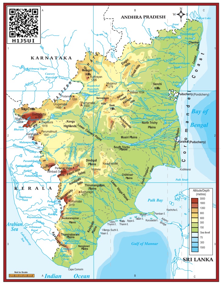
The Eastern Ghats
Unlike
Western Ghats, Eastern Ghats is a discontinuous and irregular one. It is
dissected at many places by the rivers, which drain into the Bay of Bengal. Its
height ranges from 1,100 to 1,600 metres. These hills separate the plains from
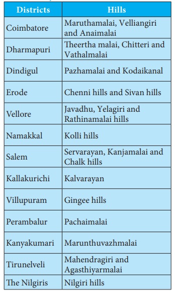
plateaus. Javadhu, Servarayan, the Kalrayan, Kollimalai and Pachaimalai are the
major hills of the Eastern Ghats of Tamil Nadu and are located in northern
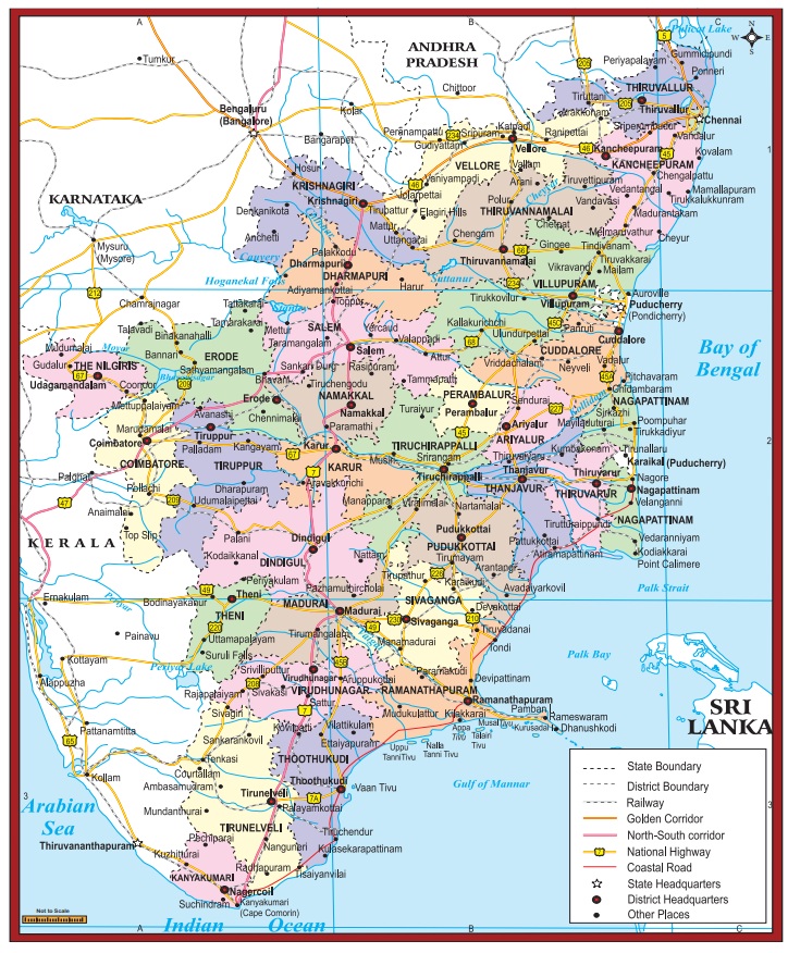
districts of the state.
Javadhu Hills
Javadhu
hills are an extension of the Eastern Ghats spread across parts of Vellore and
Tiruvannamalai districts and separates these two districts. Many peaks with the
height of 1,100–1,150 metres are located in this range. Melpattu is its highest
peak. Many parts of this range are covered with bluish grey granites. It is
noted for its fruit bearing trees, medicinal herbs and sandalwoods. Due to
illegal logging, sandalwood trees are disappeared now.
Kalvarayan Hills
The name
‘Kalvarayan’ comes from the word ‘Karalar’, the ancient name of the present
tribes. It is another major range of hills in the Eastern Ghats of Tamil Nadu.
This range, along with the Pachaimalai, Aralvaimalai, Javadhu and Servarayan
hills, separates the river basins of Cauvery and Palar. The height of this hill
ranges from 600 to 1,220 metres.
Servarayan Hills
It is a
mountain range located near the Salem city with the height ranging from 1,200
to 1,620 metres. The name of the range comes from a local deity, Servarayan.
The highest peak in the southern part of the Eastern Ghats is located in this range.
The peak is Solaikaradu and its height is 1,620 metres. The hill station
Yercaud, which is known as poor man’s Ooty, is located on this range.
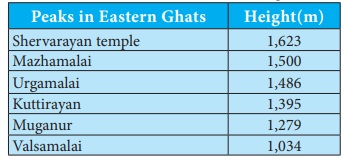
Servarayan temple is its highest point (1623 metres).
Kolli Hills
It is a small mountain range located in Namakkal district. It covers an area of about 2,800 sq.km. It rises up to 1300 metres. This is a mountain range that runs almost parallel to the east coast of South India. Arpaleeswarar temple located on this range is an important pilgrim centre. It has the largest cover of evergreen or shola forest when compared to other parts of the Eastern Ghats. Several coffee plantations, fruits, flowers and silver-oak estates are found in this region.
Pachaimalai
It is the
lowest hill range, spreads over the districts of Perambalur, Tiruchirapalli and
Salem. In Tamil language, pachai means green. The vegetation in this range is
greener than the vegetative cover of the other hills in this region. Hence it
is named as ‘Pachai malai’.
Jackfruit is a popular seasonal agricultural product of this hills.
Why are mountain heights measured from mean sea level and not from ground level?
Related Topics