Chapter: 10th Social Science : Geography : Chapter 7 : Physical Geography of Tamil Nadu
Plateaus of Tamil Nadu
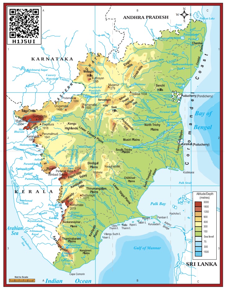
Plateaus
Plateaus
of Tamil Nadu are located between the Western Ghats and the Eastern Ghats. It
is roughly triangular in shape and covers an area of about 60,000 sq.km.
Bharamahal
plateau is a part of the Mysore plateau situated in the northwestern part of
Tamil Nadu. Its height ranges from 350 to 710 metres. Dharmapuri and
Krishnagiri districts are located in this region.
Coimbatore
plateau lies between the Nilgiris and Dharmapuri districts. Its height varies
from 150 to 450 metres. This region includes Salem, Coimbatore and Erode districts.
Moyar river separates this plateau from the Mysore plateau.
Rivers
like Bhavani, Noyyal and Amaravathi, which originate from Western Ghats, form
valleys in this region. Many intermontane plateaus are found in the region of
the Nilgiris. Sigur plateau is one such plateau.
Madurai
plateau found in Madurai district extends up to the foothills of the Western
Ghats. Vaigai and Thamirabarani basins are located in this zone.
Related Topics