Chapter: 11th 12th std standard Geography earth space Higher secondary school College Notes
Procedure for Undertaking Prismatic Compass Survey

Procedure for Undertaking Prismatic Compass Survey
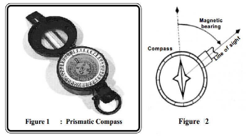
1. Collect a Prismatic Compass, a Sighting Pole and possibly a Chain for the Fieldwork. Try not to wear too many jewellery or rings as the metals can interfere with the compass readings.
2 Remember that Compass readings are made along straight segments of a boundary. Irregular paths (or boundaries) should therefore be first divided into straight segments before readings are taken.
3 To begin, pick the prismatic compass and locate the Starting Point (station 1). Let your partner move to station 2 with the sighting pole. Your partner must then hold the pole upright from the position marked station 2. Take a reading from your location (marked station 1) onto the sighting pole at station 2 and record the azimuth (angles) you get.
4 To verify whether the forward azimuth reading you made is correct, exchange positions with your partner (or preferably let your partner take a back azimuth onto the sighting pole now located at station 1). As a rule, if the forward azimuth is greater than 180o, you should subtract 180 from the forward azimuth to get the back azimuth but if the forward azimuth is less than 180o you should add 180 to it to get the back azimuth. With the rule, make a quick check of the forward azimuth you made and record it if it is right. If it is wrong, redo the reading all over.
5 Record the forward azimuth you read earlier.
6 Measure the segment of the boundary between station 1 and station 2 and record your answer beside the azimuth reading for this segment. You may use a chain or a tape and remember to take the measurement in feet. In the absence of a chain or a tape, you may take the measurements by pacing along the boundary and counting
the number of paces you make. Generally, a pace taken in a relaxed mood (not running) is about a yard (three feet) for many people. If you will use this method, you should first determine the length of your pace by marking three feet segments on the floor and walk along them for some time.
7 Walk along the boundary segment between station 1 and station 2 and make any other required readings such as resection or intersection then record such measurements on the page you have already opened. Make some sketches if necessary, to portray the features and positions you find in the field.
8 Now go to station 2 and let your partner move with the sighting pole to station 3. Take the forward and backward azimuths as explained above and record only the forward azimuth in your survey book. Check to make any required chain and compass readings along the segment between stations 2 and 3 and then move on to the next segment. Continue with the process in the same manner as described until all stations (or segments) are measured and the measurements recorded in your notebook.
9 . Keep your note book entries for you shall use it to plot the shape of land you measure in the field. You will also hand in your note book entries for grading.
Related Topics