Mapping Skills | Geography - History of Mapping (Map as a Tool) | 9th Social Science : Geography: Mapping Skills
Chapter: 9th Social Science : Geography: Mapping Skills
History of Mapping (Map as a Tool)
Map as a Tool
A map is the basic tool of a geographer. It illustrates the earth’s surface
clearly and effectively through a combination of drawings, words and symbols. Thus, maps form an integral part of teaching
geography. A map is
a location guide.
History of Mapping
The ancient Babylonians, Romans, Greeks and Egyptians were the first
people to create maps. For thousands of years, most
people thought that the earth was flat.
For many centuries,
hand-drawn flat maps
and charts assembled
from information collected
visually by explorers
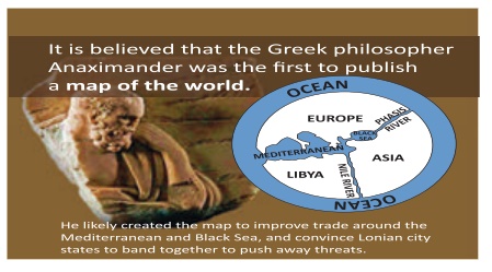
were produced. As early as 300 BC(BCE), the ancient Greeks
theorised that the earth was round
and discarded maps of a flat earth. Herodotus,
Anaximander, Pythagoras,
Eratosthenes, Ptolemy and Al Idrisi were some of the major contributors who mapped the world.
More commonly known as the Babylonian Map of the World, the Imago Mundi is considered the oldest surviving world map. It
is currently on display at the British
Museum in London. It dates back to between
700 and 500 BC(BCE)
and was found in a town
called Sippar
in Iraq. The carved map depicts
Babylon at the
centre. Nearby are places like Assyria and
Elam, all surrounded by a “Salt Sea” forming
a ring around the cities.
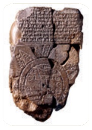
Outside the ring, eight islands or regions are carved onto the tablet. The map is accompanied by a cuneiform text describing
Babylonian mythology in the regions depicted on the
stone.
The introduction of printing press
during the 12th century
in China and 15th century in Europe helped to produce more maps. Spanish adventurers made maps of North America as the continent was explored during the 15th century. Gerardus
Mercator from Belgium
was the leading cartographer of the mid-16th century, who developed projections in map making. The uses of aerial
photographs and satellite imageries
stimulated map-making in the nineteenth
and twentieth centuries.
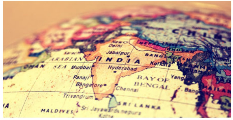
The foundation for map-making in India was
laid during the Vedic
period. Mahabharata conceived
a round world surrounded
by water. Surveying
and map-making were an integral part of the revenue collection
procedure in the medieval period. E.g.: Sher Shah Suri’s
revenue maps and Rajendra Chola’s
land survey techniques. Today, the Survey of India produces maps at different scales
for the entire country.
Related Topics