Chapter: 12th Geography : Chapter 6 : Geoinformatics
Applications of remote sensing
Applications of remote sensing
1. Agriculture
The satellites have ability to image individual fields, regions and countries on a frequent revisit cycle. Customers can receive field-based information including crop identification, crop area determination and crop condition monitoring (health and viability). Satellite data are employed in precision agriculture to manage and monitor farming practices at different levels.
2. Forest Management
The forest - fire, sudden deforestation, encroachment of forest- land are recent challenges to the ecologist. It can be easily identified and curbed with the help of remote sensing satellite pictures.
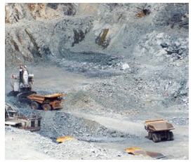
3. Geology
Various fields Remote sensing techniques used in geology are
* Lithological mapping
* Structural mapping
* Geomorphological mapping
* Mineral exploration
* Hydrocarbon exploration
* Sedimentationmapping and monitoring
* Geo-hazard mapping
CASE STUDY
NASA launches world's lightest satellite designed by 18-year-old Tamil Nadu student.
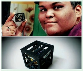
India once again broke a global space record by launching the world's lightest satellite weighing a mere 64 grams, called Kalamsat. It was designed and developed not by professional space scientists and engineers, but by 18-year-old Tamil Nadu student Rifath Sharook and his team. The tiny satellite, named after Abdul Kalam, was flown by a NASA sounding rocket on 22 June, 2017 and Kalamsat was the only Indian payload in the mission. Mission director Srimathy Kesan that the total flight time of the rocket was 240 minutes. The satellite, assembled at her T.Nagar residence in Chennai. The satellite was separated from the rocket after spending 125 minutes in the space's micro-gravity environment. Sharook’s project, the first to be manufactured via 3D printing, got selected through a competition, ‘Cubes in Space', sponsored jointly by NASA and 'I Doodle Learning'. The project aims to take the performance of new technology to space.
4. Oceanography
Satellite remote sensing plays an important role in coastal zone management. It allows us to locate and regularly monitor various aspects such as bathymetry (the measurement of the depth of water in water bodies), chlorophyll content, suspended sediment concentration, etc.
5. Cartography
Remote sensing aids in extensive surveys that are made from high altitudes to show the urban development, rural development, mountain areas, deserts, etc which help the cartographers. High-resolution satellite cameras located at altitudes of several hundred kilometres can record details as small as a few metres on the surface of the Earth.
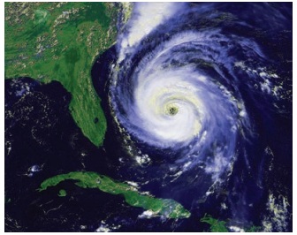
6. Meteorology
The radar system is basically used to collect the weather data. It collects meteorological data from unmanned land/ ocean based Data collection platforms and serves as a communication satellite for rapid exchange of meteorological data among centres and for rapid dissemination of weather forecasts warnings etc, to user agencies.
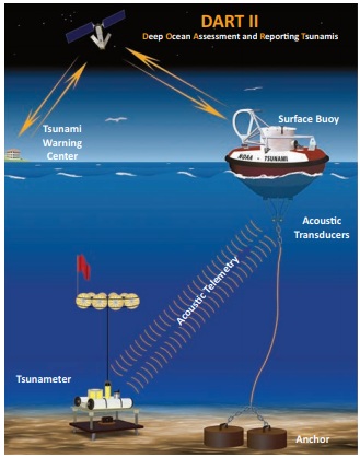
7. Topography
Topography specifically involves the recording of relief or terrain, the three-dimensional quality of the surface, and Acousc Telemetry Tsunameter Anchor the identification of specific landforms. Topographic maps usually portray both natural and manmade features. They show and name works of nature including mountains, valleys, plains, lakes, rivers, and vegetation. They also identify the principal works of man, such as roads, boundaries, transmission lines, and major buildings.
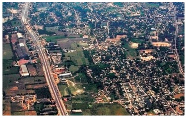
8. Urban Planning
These information systems also offer interpretation of physical (spatial) data with other socio- economic data, and thereby providing an important linkage in the total planning process and making it more effective and meaningful. Digitization of planning base maps has facilitated updating of base maps wherever changes have taken place in terms of land development etc. Superimposition of any two digital maps which are on two different scales is feasible.
Related Topics