Advantages, Google Earth - Bhuvan | 9th Social Science : Geography: Mapping Skills
Chapter: 9th Social Science : Geography: Mapping Skills
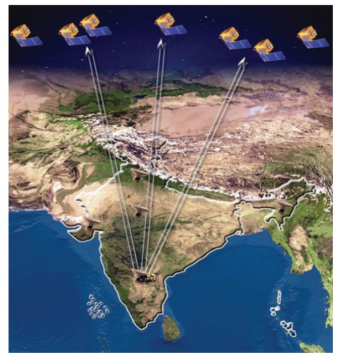
Bhuvan
BHUVAN
Bhuvan (Sanskrit for
Earth)
is a free
internet based computer application launched by the Indian Space Research
Organization (ISRO) on August 12th 2009. It
enables visualization of Indian Remote Sensing (IRS) images taken over a year ago, by ISRO’s
seven satellites, including CartoSat-1
and CartoSat-2. Using Bhuvan connected to Internet, one can explore places of interest, scenes of events in the news or parts around
the world they may never visit in person,
by either entering the
names of places or co-ordinates
(latitudes and longitudes). Bhuvan has tremendous uses for scientists, academicians, policy makers and the general public.
Advantages
·
Bhuvan,
due to 3D rendering, gives the impression of moving through real space through
the entire globe
·
Students
can use Bhuvan to understand subjects ranging from Sciences to History of
places.
·
It
provides information on natural resources and timely information on disasters.
· Administrators use it for monitoring various developmental schemes.
Google Earth
Google Earth is a web based computer application. Google Earth
is a virtual globe that renders
a 3D representation of the Earth. It combines
the power of Google Search
with maps, satellite
imageries, aerial photographs, GIS
data and 3D buildings to visualize the world.
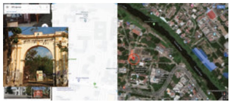
Google Earth allows users to see cities and
buildings looking perpendicularly down or
at a tilted angle. Google Earth allows users to search for addresses of some
countries, enter coordinates or simply use
the mouse to browse a location. Google
Earth also has
Digital Elevation Model (DEM) data for many major cities. This means
one can view
Mount Everest or buildings in three dimensions, instead of 2D.
Do you want to locate your house using Google Earth? Follow the following steps
1)
Start Google
Earth by double-clicking on the Google Earth Icon
or browse the icon in the ‘Start’ menu. This will start
the program.
The entire Earth
(as a globe) will be shown by default.
2)
Close Start-Up-Tip and start to explore and familiarize yourself with the Google
Earth main menu on the top left
on your screen,.
3)
Windows-based: Click
on ‘Tools’,
select ‘Options‘ and note the five tabs across the top of the ‘Options’ box.
Mac-based: Under the Google Earth’ main menu select
‘Preferences’
In the ‘3D View’ tab in the ‘Terrain’ box near the bottom, set
‘Elevation Exaggeration’ to ‘3’. Click ‘Apply’ to close the box. This will
exaggerate the elevation relief by a factor of 3.
Google Earth Options ‘3D View’ tab with ‘Terrain’ Elevation
Exaggeration circled in red.
With development
of such tools enabling flexible ways
of viewing and interacting with
geographic information, the ability
of users to understand the information presented and the overall
understanding of the world around us will surely progress.
Related Topics