India - Location, Relief and Drainage | Geography | Social Science - Map exercises, Activities | 10th Social Science : Geography : Chapter 1 : India - Location, Relief and Drainage
Chapter: 10th Social Science : Geography : Chapter 1 : India - Location, Relief and Drainage
Map exercises, Activities
VII. Map exercises
Mark the following in the outline map of India
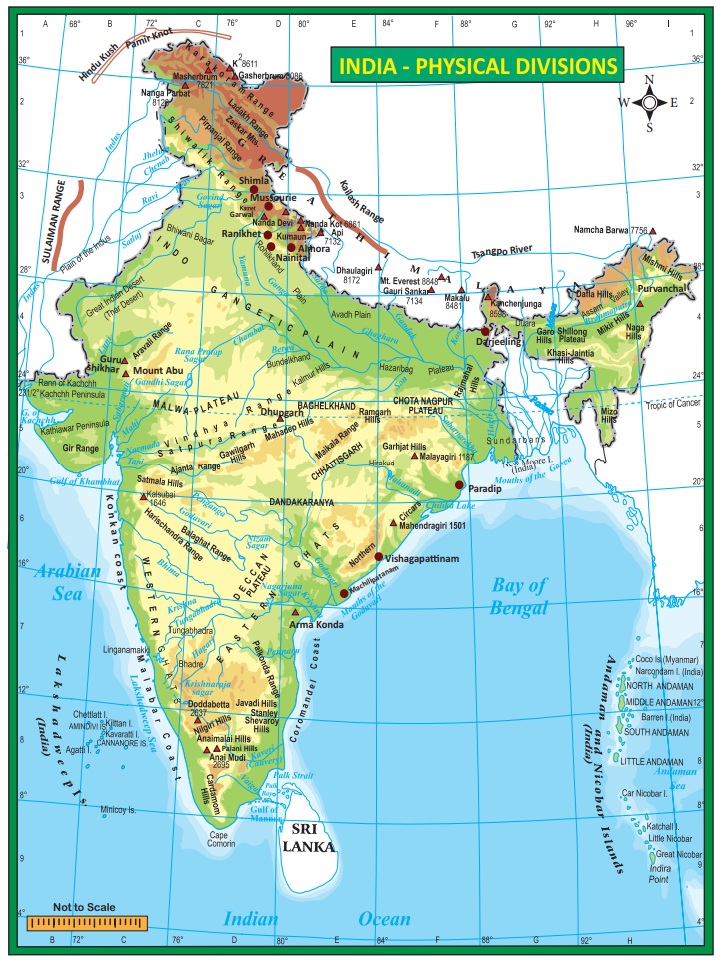
1. Major mountain ranges – Karakoram, Ladakh, Zaskar, Aravalli, Western Ghats, Eastern Ghats.
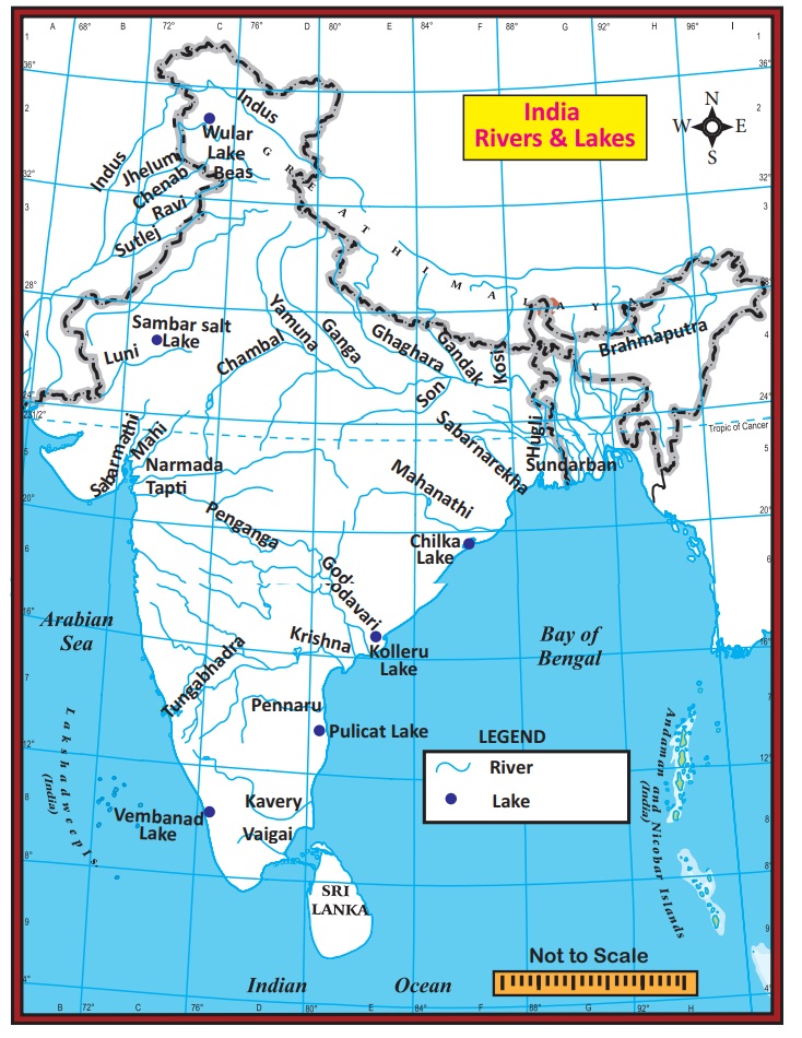
2. Major rivers – Indus, Ganga, Brahmaputra, Narmada, Tapti, Mahanadi, Godavari, Krishna & Kaveri.
3. Major plateaus – Malwa, Chotanagpur, Deccan.
VIII. Activities
1. Observe the Peninsular Plateau map of India and mark the major plateau divisions of India
2. Prepare a table showing the major West flowing and East flowing rivers of peninsular India.
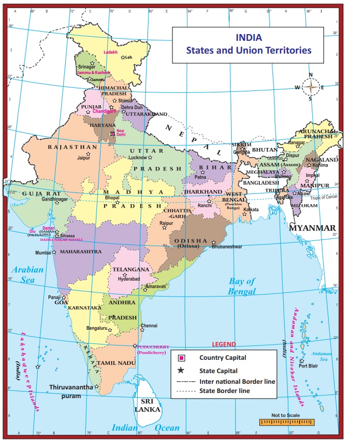
3. Assume that you are travelling from West Bengal to Gujarat along the beautiful coasts of India. Find out the states which you would pass through?
4. Find out the states through which the river Ganga flows.
5. Prepare a table showing the major rivers in India and findout it’s tributaries, origin, length and area.
Related Topics