Chapter: 11th Geography : Chapter 1 : Fundamentals of Geography
Evolution of Geography
Evolution
of Geography
Geography had evolved over a long period of time.
Some of the earliest geographical studies go back about four thousand years ago
through explorations. The early explorers travelled and tried to map the new
places. The evidences of such explorations come from the archaeological
discovery of a Babylonian clay tablet map that dates back to 600 BCE. During
this time, Phoenician, Chinese and Egyptian civilisations were in the beginning
to explore places outside their homelands. It was the ancient Greek scholars
who laid the foundations and gave a solid form to geographic studies and on
these foundations, the pillars of modern geography were erected by others in
the subsequent ages. The Romans, the Arabs, the Indians, the Chinese, the Germans,
the French, the British and the American geographers have contributed to the
development and enrichment of the subject.
The Greek philosophers and scientist focused on the
spatial nature of human and physical features of the Earth. The first Greek
geographer was Herodotus (484 - 425 BCE) who wrote a number of volumes on the
human and physical geography of the Persian Empire. The other early Greek
contributors to geography are, Thales, Aristotle and Eratosthenes (276 - 194
BCE).
The earlier geographers were descriptive
geographers concerned with answering questions like ‘what is where’ on the
earth and the question like ‘why it is there’ came later. Geographers study the
location of the activities, carefully identify patterns using maps and find out
the reasons for these patterns. The areas are then described based on the
distribution of land forms, population, housing and agriculture. They discover
the linkages and movements between places and are able to infer the spatial
processes that are working in these areas.
The development of geography can be summarised in
three phases namely (1) The age of discovery (1400-1800), (2) The period
between 1800 and 1950 and (3) The period after 1950.
The age of discovery between 1400-1800
The period between 1400 and 1800 was when the
subject matter and the methodology of geography were not fully developed. The
discipline was in an embryonic stage. This period was characterised by
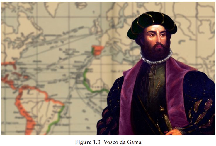
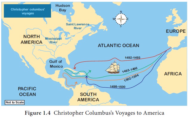
exploration, discovery and conquest through the voyages of Vasco da Gama and
Christopher Columbus. Numerous journeys of geographical exploration were
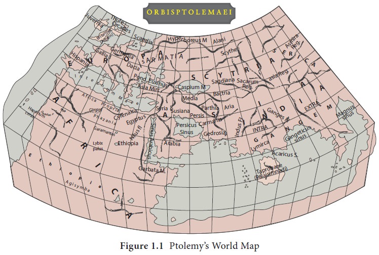
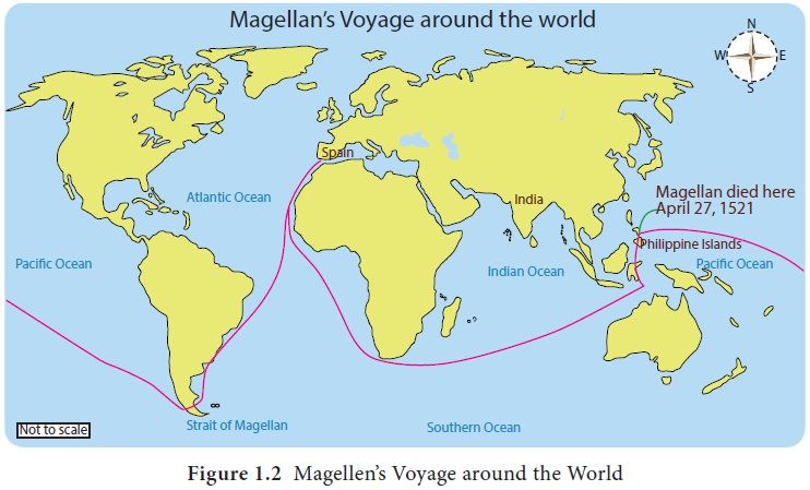
commissioned by a number of Nations in Europe (Figure. 1.1, 1.2, 1.3 and 1.4).
Most of these voyages were financed because of the potential commercial returns
from resource exploitation. The voyages also provided an opportunity for
scientific investigation and discovery. Making of maps (cartography) was
important in the discipline of geography due to the emphasis on location of
phenomena on the earth surface, e.g. location of trade routes, relief features
and settlements.
The period between 1800 -1950
The period between 1800 and 1950 was characterised
by the work of various individual philosophers who helped to expand the scope
of geography. The discipline of geography became more distinct as a subject
matter. Geographic knowledge saw strong growth in Europe and the United States
in the 1800s. This period also saw the emergence of a number of societies
interested in geographic issues. In Germany, Alexander Von Humboldt, Carl
Ritter and Friedrich Ratzel made substantial contributions to human and
physical geography. Humboldt’s publication ‘Kosmos’ in 1844, examines the
geology and physical geography of the earth. This work is still considered by
many academics as a milestone contribution to geography.
There are two schools of thought that emerged
during this period as an attempt to explain the relationship between human
beings and their environment. These were environmental
determinism and possibilism.
Proponents of environmental deterministic
school of thought such as Mackinder, Ellen Semple and Huntington believed that
human actions and activities were moulded by the physical (natural) conditions.
In several developing countries, human beings are susceptible to natural
disasters such as drought, famine, floods and earthquakes. Human beings under
such natural conditions usually surrender to nature. A good example of
environmental determinism is the influence of the natural environment on human
activities such as nomadic pastoralism. Nomadic pastoralism is so much
dependent on the natural environment. Pastoralists do very little to modify
their environment.
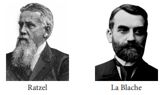
The proponents of possibilistic school of thought,
such as Vidal de la Blache saw the environment as a limiting factor rather than
as a deterministic force. According to the possibilism school of thought, human
beings have several alternatives in their environment and their actions are
influenced by the decisions they make in the environment. For instance, humans
can survive in hot or extremely cold conditions due to their ability to modify
the environment to suit them. A good example is that in many arid countries
such as Israel, humans have overcome the constraints set by the natural
environment such as low rainfall, high temperatures and poor soils.
The period after 1950
Until 1950s, geography was more of an art subject
where facts were established by casual observation in the field rather than by
careful measurement and hypothesis testing. In the 1950s there was a new
development in the discipline and several laws were established to explain
geographical phenomena. Using the laws, it is possible to predict what will
happen in the future. If we can predict successfully, we can plan and limit the
extreme possibilities.
One of the important developments in this period
was the use of quantitative techniques in physical and human geography. These
techniques refer to various statistical tools that are used to synthesise the
data from maps, field, laboratories and questionnaires. Quantification came
about as a result of the expanding scope of the discipline as well the need to
understand the processes that were becoming more diversified and complicated.
This quantitative revolution was referred to as a
revolution because it marked a new beginning in the way the subject matter of
geography was to be studied. The quantitative revolution involves the use of
statistics, mathematical equations and the use of deterministic models. Many
geographers believed that numbers are more precise, and therefore perceived as
more scientific compared to words. The map, both as graphic language and visual
representation, continues to be used as a geographical tool and at present with
the valuable assistance of remote sensing and Geographical Information Systems,
map making has become digital and easier especially due to advances in computer
and software technologies.
Related Topics