Topographical Map | Geography - Marginal Information | 11th Geography : Chapter 11 : Interpretation of Topographical Map
Chapter: 11th Geography : Chapter 11 : Interpretation of Topographical Map
Marginal Information
Marginal
Information
Marginal information includes the
topographical sheet number, its location, grid references, its extent in
degrees and
Marginal information is classified in
to:
•
Extra Marginal Information- Serial Number, name of the State, District and other
general information.
•
Intra Marginal Information – Grid information, contour values, names of the next
nearest places connected by transport lines and distance in Km.
•
Inter Marginal Information or Body of the Map– depicts the topography by using various Signs and symbols
Extra Marginal Information
a. Sheet Name: The sheet name or title of the map
is found in bold print at the top centre of the map and in the lower left area
of the map margin. A map is generally named after the largest settlement
contained within the area covered by the sheet or the name of the state, a part
of which is covered by the map.
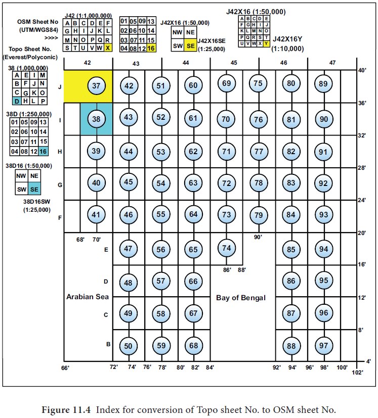
b. Sheet Number : The sheet number is found in bold print in both the upper right and lower left areas of the margin .
Sheet number helps us to understand
the geographical extent covered by the sheet. It is also an indicator of map
scale i.e. whether the map scale is 1:1000,000 or 1:250,000 or 1:50,000 or
1:25,000.
c. District name : The name of the districts or major
political subdivisions covered in the map are given in the top left margin of
the map .
d. Edition Number: The edition number is found in bold
print in the upper right area of the top margin and the lower left area of the
bottom margin. Editions are numbered consecutively; therefore, if you have more
than one edition, the sheet with the highest number is the most recent.
e. Magnetic Declination Diagram: This is located in the top right margin or lower margin of large-scale maps and indicates the angular relationships between true north, grid north, and magnetic north. On maps of 1:250,000 scale, this information is expressed as a note in the lower margin.
f. Scale: The scale is found in the centre of the lower margin. The scale is
represented as a representative fraction and also as a graphical scale. The
representative fraction gives the ratio of map distance to the corresponding
distance on the earth’s surface. For example, the scale 1:50,000 indicates that
one unit of measure on the map equals 50,000 units of the same measure on the
ground. Graphical Scales are located in the centre of the lower margin. They
are rulers used to convert map distance to ground distance. Maps have three or
more bar scales, each in a different unit of measure. Care should be exercised
when using the scales, especially in the selection of the unit of measure that
is needed.
g. Index to Boundaries : The index to boundaries diagram appears in the
lower right margin of all sheets. This diagram, which is a miniature of the
map, shows the boundaries that occur within the map area, such as National,
state, district or thasil boundaries.
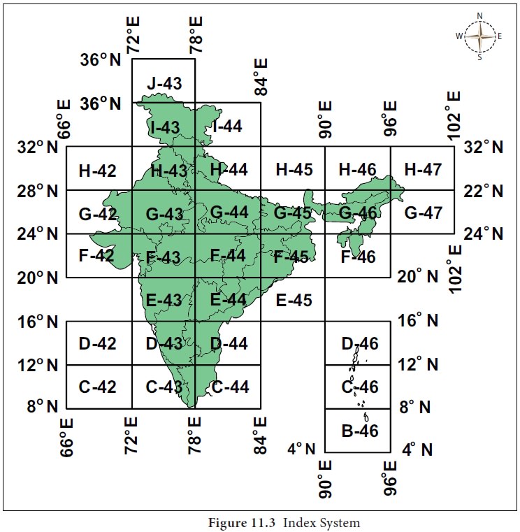
h. Index to Adjoining Sheets : Maps at all standard scales contain a diagram that
illustrates the adjoining sheets. On maps at 1:1000,000 and larger scales , the
diagram is called the index to adjoining sheets. The diagram usually contains
nine rectangles with the central rectangle representing the sheet under
consideration.. All represented sheets are identified by their sheet numbers.
i. Contour Interval Note: This note is found in the centre of the lower
margin normally below the bar scales. It states the vertical distance between
adjacent contour lines of the map. When supplementary contours are used, the
interval is indicated. In recent edition maps, the contour interval is given in
meters instead of feet.
j.
Legend : The legend is
located in the lower left margin and lower right margin. It illustrates and identifies
the topographic symbols used to depict some of the more prominent features on
the map. The symbols are not always the same on every map. Always refer to the
legend to avoid errors when reading a map.
k. Grid Reference Box: This box is normally located in the centre of the
lower margin. It contains instructions for composing a grid reference.
l. Unit imprint and Symbol: The unit imprint and symbol is on the left side of the lower
margin. It identifies the agency that prepared and printed the map with its
respective symbol. This information is important to the map user in evaluating
the reliability of the map.
Related Topics