Weather Maps | Geography - Weather Forecasting | 11th Geography : Chapter 12 : Weather Maps
Chapter: 11th Geography : Chapter 12 : Weather Maps
Weather Forecasting
Weather
Forecasting
Weather forecasting plays a major role in
predicting the weather in the near future. It is difficult to predict the
weather that could prevail in the future. A thorough understanding of
meteorology is necessary for the forecast familiarity with the local weather
helps to correlate the existing weather conditions and in forecast the future
weather. The prediction of weather for a given place, is normaly for a period
of time, for instance is for 24 to 48 hours.
The methods used for weather forecasting are
conventional, synoptic, numerical weather prediction. Conventional interprets
the trend of weather system. Numerical solutions, global circulation models,
variation analysis for synoptic hours.
The weather forecast categories are now casting,
short range, medium range long range and forecasting. Now casting gives the
details of the current weather and forecasts up to a few hours ahead using
radar products.
Short range forecasts is for one to three days.
Weather mainly rainfall for each successive 24 hour intervals may be predicted
up to three days. It concerned about the observed latest weather charts and new
systems.
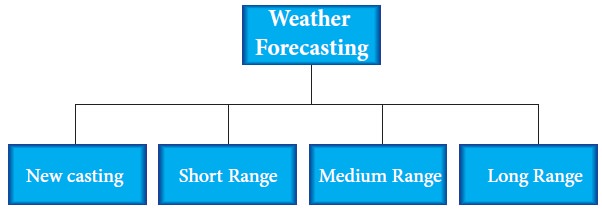
Medium range forecasts are for 4 to 10 days –
average weather conditions and the weather on each day may be prescribed with
progressively lesser details and accuracy than that for short range forecasts
dependent on NWP (Numerical Weather Prediction) products.
Long range forecast is an extended range forecast
for more than 10 days in a season. It may range from a monthly to a seasonal
forecast. Local forecast is a location specific forecast valid for a radius of
50 km around the weather stations.
A persistence forecast predicts that future weather
will be the same as present weather. Analogue forecast will be like the weather
that historically occurred when similar conditions were present. Statistical
forecast is made routinely of weather elements based on the past performance of
computer models. Trend forecast: surface weather systems tend to move in the same
direction and at approximately the same speed as they have moved.
Current Scenario of Weather Forecasting
The weather satellites monitor the weather
conditions and provide accurate information of weather. Satellite imageries are
pictorial representations of radiation reaching the sensors from the earth from
the different spectral bands that imprints the accurate weather elements such
as winds, rainfall, and sea surface temperature.
Weather forecasting is based on the weather
observation of surface data based on radars. Numerical weather prediction (NWP)
using current and past observations to predict weather in near future AWIPS-
Advanced weather interactive processing systems used by forecasters and process
satellite, radar, surface observations, and weather forecasting models.
Occultation method is one of the most recent and
capable atmospheric remote sensing technique applied to GPS measurements.
The meteogram is a chart that shows how one or more
weather variables has changed at a station over a given period of time.
Auxiliary charts- satellite imageries, satellite bulletins, satellite
observations and current weather observations. These predictions are
significant for warning of natural hazards.
Related Topics