Wind, Pressure | Geography - Reading Weather Map | 11th Geography : Chapter 12 : Weather Maps
Chapter: 11th Geography : Chapter 12 : Weather Maps
Reading Weather Map
Reading
Weather Map
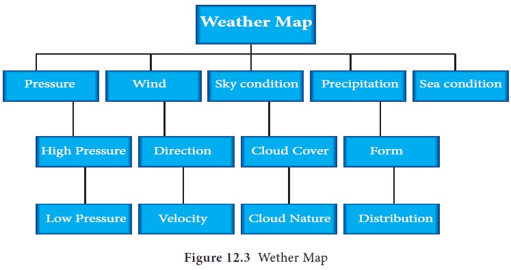
Based on the above flow chart basic
weather elements are represented. The following points are to be described
while reading the weather map.
Pressure
•
Location of high pressure shown as ‘H’ in the weather map. The number
and location must be specified
•
Location of low pressure, represents as ‘L’ the number of occurrence,
location and nearby isobar value to be noted.
•
Trend of Isobars-The general path of isobars are to be observed.
•
Pressure gradient denotes gentle or steepness based on the spacing of
isobars. When the isobars are closely spaced the pressure gradient is steep and
gentle if the isobars are widely spaced.
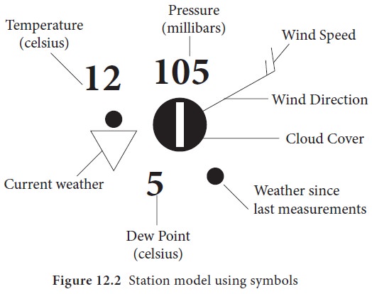
Wind
a.
In weather Map interpretation, wind barbs indicate wind direction and
wind speed. The staff part shows wind direction. The staff is a line above the
circle that indicates wind direction. The number and size of the feather and
pennants included to the wind barb show the wind velocity.
b.
Sky condition is represented using circle, shaded according to the cloud
cover
c.
Sea condition is shown as codes, for example, Ro- Rough.
d.
Precipitation and temperature and the other weather data are generally
tabulated and attached to the Indian daily weather map.
Related Topics