Introduction | Geography - Maps and Scale | 11th Geography : Chapter 9 : Maps and Scale
Chapter: 11th Geography : Chapter 9 : Maps and Scale
Maps and Scale
Introduction
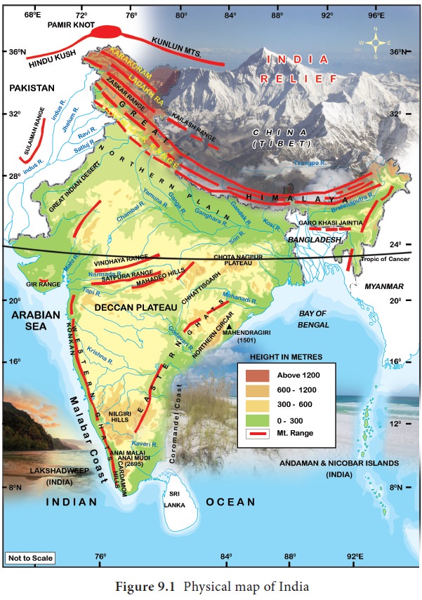
A map is a visual representation of an entire world or a part of the earth, represented on a flat surface drawn to scale. Maps attempt to represent both physical and cultural features like relief, climate, natural resources, political boundaries, roads, population, economic activities and so on.
Components of a map
Basic Components of a map are title, legend, direction, scale and source. It gives the extent of latitude and longitude of the area mapped.
Title
Title tells about the content of the map and is placed mostly at the top centre or at the bottom centre of the map.
Scale
The scale of the map is ratio between two places on the map and their corresponding distance in the ground. It can be expressed as statements, representative fraction, or as linear scale. The scale of a map should be placed at a prominent place. It can be placed just below the title or somewhere at the bottom.
Legend
It explains about different signs and symbols used in a map and is usually placed at the left or right corner at the bottom of the map.
Direction
It is a convention that top of the map is oriented towards north and this is represented by an arrow pointing upward placed at the top right corner of the map. Sometimes a Compass Rose is used instead of an arrow to show the direction.
Source
Every map must give the source of the data used. The source should normally be given outside the frame of the map on the bottom right. On the bottom left the name of the author, publisher, place of publication and year of publication should be given.
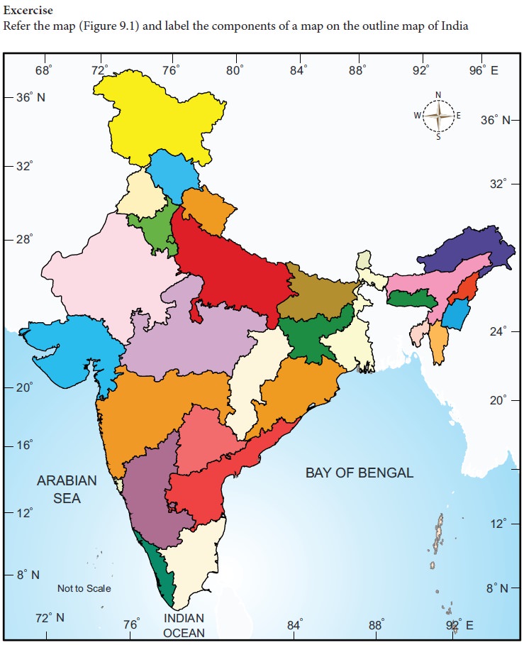
1. Based on the details given below, mark the components of the map in their appropriate place in the map of Tamil Nadu.
Title: Tamil Nadu - Distribution of rainfall during Northeast Monsoon 2017
Scale : 1:2,00,000,000
Legend low rainfall, moderate rainfall, heay rainfall
Latitude 8°N to 13°N. Longitude 74 to 80E
2. Draw the symbols used in topographic sheet to show various categories of
• Railway lines
• Roadways
• Water features
• physical features
• cultural features
• vegetation
Related Topics