Chapter: 12th Geography : Chapter 10 : Map Projection
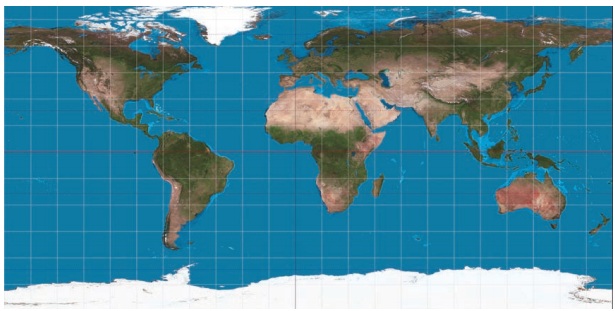
Cylindrical Equal Area Projection / LambertŌĆÖs Cylindrical Equal-area projection
Construction
of Some selected Map Projections
Cylindrical Equal Area
Projection / LambertŌĆÖs Cylindrical Equal-area projection
It is devised
by JH Lambert in 1772. It is a normal perspective projection onto a cylinder tangent
at the equator.
Properties of Cylindrical Equal Area Projection
* Parallels
and meridians are straight lines.
* The meridians
intersect parallels at right angles.
* The distance
between parallels decreases toward the poles but meridians are equally spaced.
* The length
of the equator on this projection is same as that on globe but other parallels are
longer than corresponding parallels on globe. So, the scale is true along the equator
but is exaggerated along other parallels.
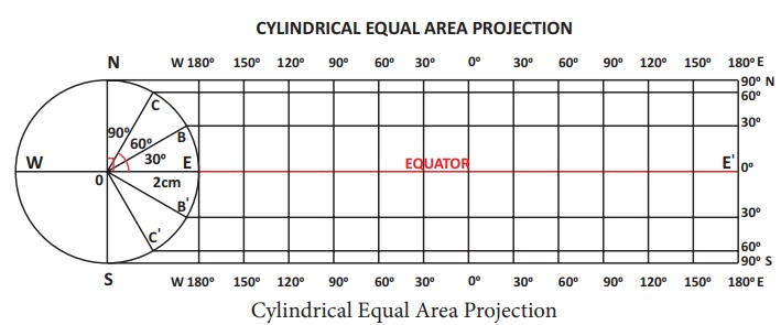
Example 1
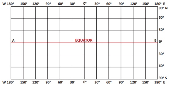
Construct a cylindrical equal area projection for the whole globe
with a reduced earth radius of 2 cm and the latitudinal and longitudinal interval
30┬░
Construction:
* Draw a
circle of 2 cm radiuswith O as centre.
* Draw the
equator (WE) and the Polar N-S axis.
* Mark the
angles of 30┬░, 60┬░ for both the hemispheres. And label it as B, C, B' and C' respectively.
* Extend
the line WE to EŌĆÖ
* Divide
the line EEŌĆÖ into to 12 equal parts (360/30) with the distance of EB. This line
represents the Equator.
* Through
each point draw perpendiculars which represent the longitudes
* Draw parallel
lines at N, C, B, B', C' and S equal to EEŌĆÖ to represent 30┬░, 60┬░ and 90┬░ latitudes
for both the hemispheres. Complete the projection as shown in Figure.
Cylindrical Equi ŌĆōDistant Projection
This is a Projection on to a cylinder which is tangent to the equator. It is believed to be invented by Marinus of Tyre, about C.E. 100.
Properties of Cylindrical Equi-Distant Projection
* Poles are straight lines equal in length
to the equator.
* Meridians are straight parallel lines,
equally spaced and are half as long as the equator. All meridians are of same length
therefore scale is true along all meridians
* Parallels are straight, equally spaced
lines which are perpendicular to the meridians and are equal to the length of the
equator.
* Length of the equator on the map is
the same as that on the globe but the length of other parallels on map is more than
the length of corresponding parallels on the globe. So the scale is true only along
the Equator and not along other parallels.
* Distance between the parallels and
meridians remain same throughout the map.
* Since the projection is neither equal
area nor orthomorphic, maps on this projection are used for general purposes only.
Example 2
Construct a cylindrical
equi-distant projection for the whole globe with a reduced earth radius of 2 cm
and the latitudinal and longitudinal interval 30┬░.
Construction:
* Draw a circle of 2 cm radius with O
as centre.
* Mark the angles of 30┬║ northern hemisphere
and label it as C.
* Draw a line AB long to represent the
equator.
* Since the meridians are to be drawn
at an interval of 30┬║ divide AB into 360/30 i.e 12 equal parts with distance of
EC.
* To draw meridians, erect perpendiculars
on the points of divisions of AB. Take these perpendiculars equal to the length
specified for a meridian and keep half of their length on either side of the equator.
* A meridian on a globe is subtended
by180┬║. Since the parallels are to be drawn at an interval of 30┬║, divide the central
meridian into 180/30 i.e. 6 parts.
* Through these points of divisions draw
lines parallel to the equator. These lines will be parallels of latitude. Complete
the projection as shown in Figure.
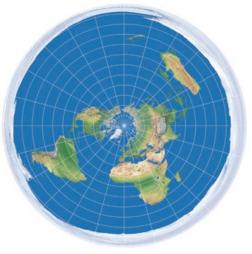
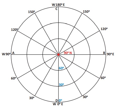
Polar Zenithal Projection
Polar Zenithal Equal area projection
This projection is invented by J.H Lambert
in the year 1772. It is also known as LambertŌĆÖs Equal Area Projection.
* The pole is a point forming the centre
of the projection and the parallels are concentric circles.
* The meridians are straight lines radiating
from pole having correct angular distance between them.
* The meridians intersect the parallels
at right angles.
The scale along the parallels increases
away from the centre of the projection
* The decrease in the scale along meridians
is in the same proportion in which there is an increase in the scale along the parallels
away from the centre of the projection. Thus the projection is an equal area projection.
* Shapes are distorted away from the
centre of the projection. Scale along the meridians is small and along the parallels
is large so the shapes are compressed along the meridians but stretched along the
parallels.
* Used for preparing political and distribution
maps of Polar Regions. It can also be used for preparing general purpose maps of
large areas in Northern Hemisphere.
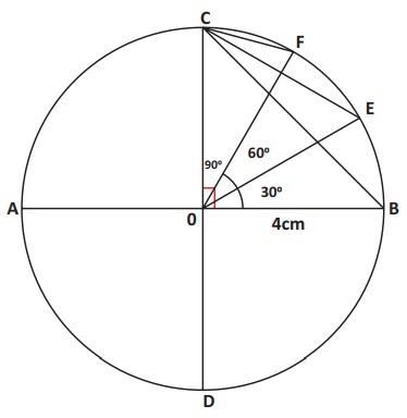
Example 3
Construct a Polar zenithal
equal area projection for the whole globe with a reduced earth radius of 4 cm and
the latitudinal and longitudinal interval 30┬░
Steps of construction:
* Draw a circle with radius equal to
4 cm representing a globe. Let CD and AB be the polar and equatorial diameters respectively
which intersect each other at right angles at O, the centre of the circle.
* Draw radii OE, OF, OC, making angles
of, 30┬░, 60┬░ and 90┬░ respectively with OB. Join CB, CE, and CF by straight lines.
* With radius equal to CF as centre draw
a circle. The point represent 900 parallel and mark it as N. This circle represents
60┬░ parallel. Similarly with centre N and radii equal to CE and CB draw circles
to represent the parallels of 30┬░ and 0┬░ respectively.
* Using protractor, draw other radii
at 30┬░ interval to represent other meridians.
* Complete the projection as shown in
Figure.
Polar Zenithal Equi-distant Projection
Properties of Polar Zenithal Equi distant Projection
* The pole is a point forming the centre
of the projection and the parallels are concentric circles.
* The meridians
are straight lines radiating from pole having correct angular distance between them.
* The meridians
intersect the parallels at right angles.
* The spacing
between the parallels represent true distances, therefore the scale along the meridians
is correct.
* The scale
along the parallels increases away from the centre of the projection.
* It is used for preparing maps of polar
areas for general purposes.
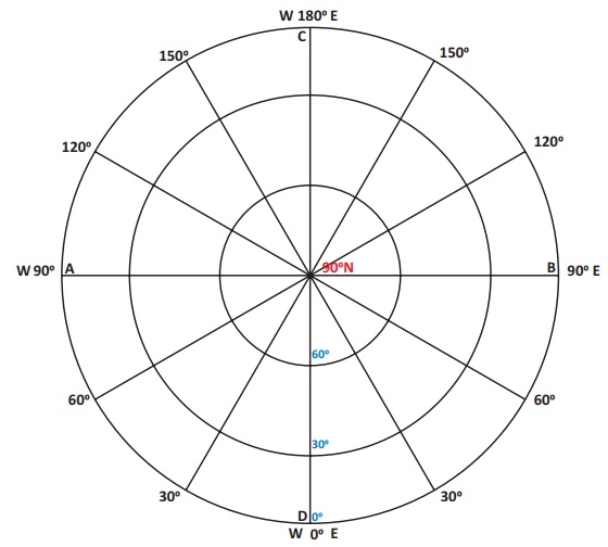
Example 4
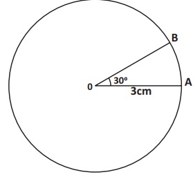
Construct a Polar zenithal
equi-distant projection for the whole globe with a reduced earth radius of 3cm and
the latitudinal and longitudinal interval 30┬░.
Steps
of construction:
* Draw a circle with radius equal to
3cm representing a globe with O as centre.
* Mark the angle of 30┬░ and label it
as AOB.
* With radius equal to AB as centre draw
a circle with centre N.
* Let CD and AB be the polar and equatorial
diameters respectively which intersect each other at right angles at O, the centre
of the circle.
* The number of intervals will be 90/30
= 3.
* Draw 3 concentric circles with N as
centre. Mark the meridians radiating from the centre N.
* Using protractor, draw other radii
at 30┬░ interval to represent other meridians.
* Complete the projection as shown in Figure.
Related Topics