Geography - Classification of Map Projections | 12th Geography : Chapter 10 : Map Projection
Chapter: 12th Geography : Chapter 10 : Map Projection
Classification of Map Projections
Classification of Map Projections
Map projections are classified on the
following criteria:
* Method of construction
* Development surface used
* Projection properties
* Position of light source
Classification based on Methods of Construction
Given below are the projections that
are based on the method of construction:
a).Perspective
Projections: These projections
are made with the help of shadow cast from an illuminated globe on to a developable
surface.
b).
Non Perspective Projections: A developable surface is only assumed to
be covering the globe and the construction of projections is done using mathematical
calculations.
Classification based on Developable Surface used
The three basic projections are based
on the types of developable surface. They are:
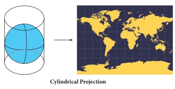
1 Cylindrical Projection
* It can
be visualized as a cylinder wrapped around the globe.
* The longitudes
(meridians) and latitudes (parallels) appear as straight lines.
* Length of equator on the cylinder is
equal to the length of the equator, therefore, it is suitable for showing equatorial
regions.
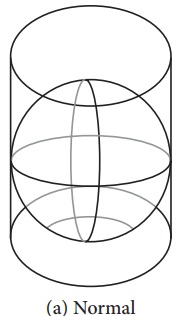
Normal:
when a cylinder has line of tangency to the equator. It includes Equirectangular
Projection, the Mercator projection, Lambert's Cylindrical Equal Area, Gall's Stereographic
Cylindrical, and Miller cylindrical projection.
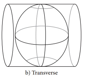
Transverse:
when cylinder has line of tangency to the meridian. It includes the
Cassini Projection, Transverse Mercator, Transverse cylindrical Equal Area Projection,
and Modified Transverse Mercator.
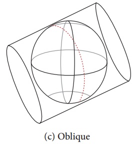
Oblique: when cylinder has line of tangency to
another point on the globe. It only consists of the Oblique Mercator projection.
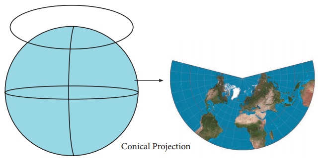
2. Conical Projection
* It can
be visualized as a cone placed on the globe, tangent to it at some parallel.
* After projecting
the graticule on to the cone, the cone is cut along one of the meridian and unfolded.
Parallels appear as arcs with a pole and meridians as straight lines that converge
to the same point.
* It can
represent only one hemisphere, at a time, northern or southern hemisphere.
* It is suitable
for representing middle latitudes.
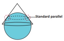
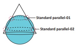
Conical projection
is divided into two. They are
Tangent: when the cone is tangent to only one of the parallel.
Secant: when the cone is not big enough to cover the curvature of earth, it intersects the earth twice at two parallels.
3. Azimuthal /Zenithal Projection
* It can be visualized as a flat sheet
of paper tangent to any point on the globe
* The sheet will have the tangent point
as the centre of the circular map, where meridians passing through the centre are
straight line and the parallels are seen as concentric circle.
* Suitable
for showing polar areas
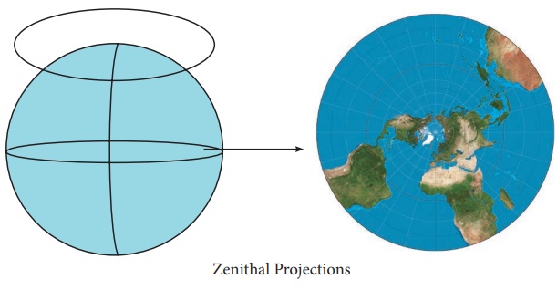
Aspects of zenithal projection:
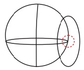
Equatorial zenithal: When the plane is tangent to a point on the equator.
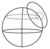
Oblique zenithal: when the plane is tangent to a point between a pole and the equator.
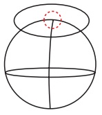
Polar zenithal: when the plane is tangent to one of the poles.
According to properties, map projections can be classified as:
Equal
area projection: It is also
known as homolographic projections. The
areas of different parts of earth are correctly represented by such projections.
True
shape projection: It is also
known as orthomorphic projections. The
shapes of different parts of earth are correctly represented on these projections.
True scale or equidistant projections:
Projections that maintain correct scale
are called true scale projections. However, no projection can maintain the correct
scale throughout. Correct scale can only be maintained along some parallels or meridians.
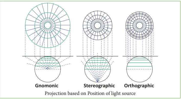
Classification based on Position of light source
Placing light source illuminating the
globe at different positions results in the development of different projections.
These projections are
Gnomonic
projection: when the
source of light is placed at the centre
of the globe
Stereographic
Projection: when the source of light is placed at the periphery
of the globe, diametrically opposite to the point at which developable surface touches
the globe.
Orthographic Projection: when the source of light is placed at infinity from the globe opposite to the
point at which developable surface touches the globe.
Related Topics