Chapter: Civil : Remote Sensing Techniques and GIS : Geographic Information System
Basic Components of Geographic Information System(GIS)

GEOGRAPHIC
INFORMATION SYSTEM
BASIC
COMPONENTS OF GIS
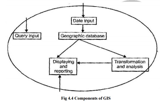
Fig 4.4
Components of GIS
Geographic
information systems have three important components they are
(i)
Computer hardware
(ii)
Set of application software modules.
(iii)
And a proper organizational contest.
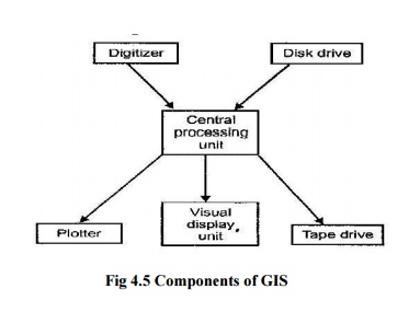
Fig 4.5
Components of GIS
1
HARDWARE COMPONENTS OF A GIS
The
general hardware components of a GIS are shown in the figure
CPU -Central
processing unit is linked to disk drive, which provides space for storing data
and programs.
Digitizer -It is a
device used to convert data from maps and documents into digital form
(Raster to Vector).
Plotter -Plotter
is used to present the results of the data processing on a paper.
Tape drive -It is
used to store data or programs on magnetic tape for communicating with
other systems.
VDU (Visual
Display Unit)-It is used to control the computer and the
otherperipherals. It is otherwise known as terminal or workstation.
Related Topics